Classic Safari 2027 - Recce Report
* Southern Africa Route Master Kim Bannister opens his recce notebook

Day 1 – Swakopmund to Sossusvlei
The town of Swakopmund is our starting point and it really is a lovely little town, our hotel is located on the beach and the main part of the town with the shops, museums and supermarkets are just a short walk away.
The city is situated at the edge of the Namib Desert and is the fourth largest population centre in Namibia. Swakopmund is a popular beach resort and characterised by 19th century German colonial architecture. The city was founded in 1892 as the main harbour for German South West Africa.
Buildings in the city include the Altes Gefängnis, a prison designed by Heinrich Bause in 1909. The Woermannhaus, built in 1906 with a prominent tower (Damara tower), is now a public library. Attractions in Swakopmund include the Swakopmund Museum, the National Marine Aquarium of Namibia, the Crystal Gallery.
From the start point at the hotel we headed east to a kart circuit on the edge of town. The plan is to use the venue as a short fun test section as our first competition of the event.
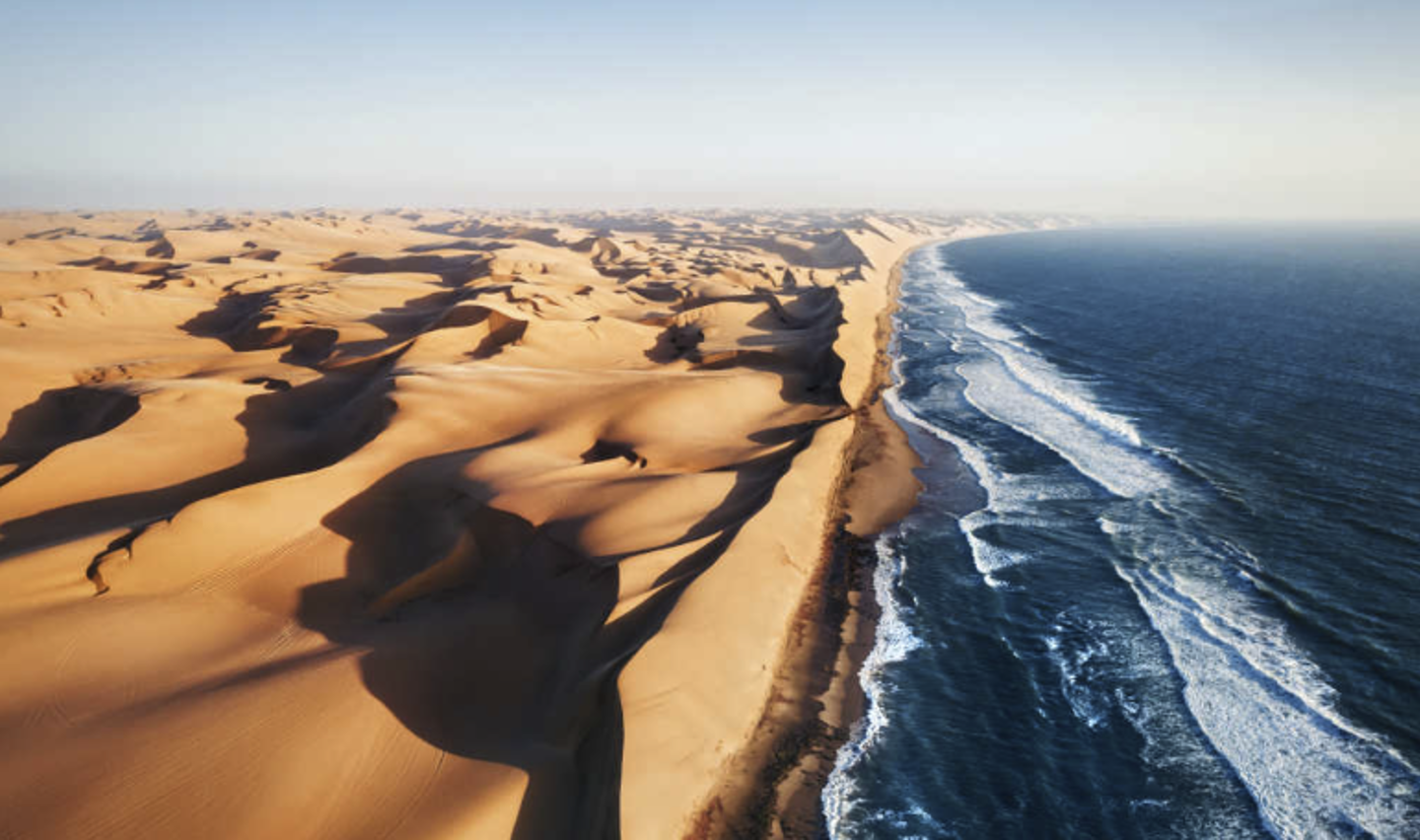
We then turned south along the Skeleton Coast towards Walvis Bay. The area's name derives from the whale and seal bones that once littered the shore, partly due to the whaling industry, although in modern times the coast also harbours the skeletal remains of the shipwrecks caused by offshore rocks and fog.
15 Kilometres outside of Walvis Bay we reached the end of the tarmac road and spent most of the next 2 days on the wide expanse of Namibian gravel.
The area had just experienced unprecedented levels of rain, so some stretches were a little bumpy and corrugated, but the graders were already out and the stretches that had been graded were fast and smooth.
The only regularity section for the day will be on good gravel over the scenic Kuiseb Pass before a long run, crossing the Tropic of Capricorn, on the way to the small settlement of Solitaire, where crews will be able to fuel both body and vehicle as there is a fuel station and a superb bakers selling the most wonderful pies and pastries.
From Solitaire it is only a short run to the accommodation for the next 2 nights in one of the many lodges on the way to Sossusvlei.
Day 2 – Rest Day Sossusvlei
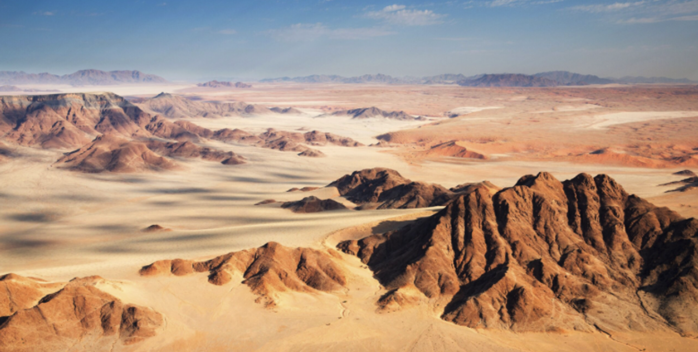
Situated in the largest conservation area in Africa (the Namib-Naukluft National Park), Sossusvlei is possibly Namibia’s most spectacular and best-known attraction. Characterised by the large red dunes that surround it. The dunes in this area are some of
the highest in the world, reaching almost 400 meters, and provide photographic enthusiasts with wonderful images in the beautiful morning and evening light.
Crews will have the opportunity to go into the heart of the dunes with one of the approved companies and their expert guides.
Day 3 – Sossusvlei to Windhoek
We returned along the gravel to Solitaire, avoiding the temptation to eat another portion of their wonderful apple pie, but did top up the fuel tank for the day ahead.
From Solitaire we headed over the spectacular Spreetshoogte Pass for today’s regularity. The road is generally good gravel, but the pass itself has brick paved on the steepest part to add to the enjoyment of the climb. We also had our first viewing of African wildlife with a solitary Wildebeest, a herd of Oryx and some playful monkeys on the side of the road.
Following the Pass a coffee was felt to be much needed, and we found a lovely little farm shop and café just a few kilometres after the finish who is looking forward to meeting you all next year.
The remainder of the run into Windhoek, Namibia’s capital city, was on well maintained gravel, little used by commercial traffic, so progress was fast and uneventful.
Just after returning to the tarmac, we encountered our first Police Checkpoint which was passed with a friendly wave and a smile from the police on duty.
The event will be staying at a lovely lodge south of the city, which was the venue for a large international conference when we went there, reflecting the quality of the venue.
Day 4 – Windhoek to Etosha West
Thanks to the out of city location of the event hotel, we could just drop back onto the southern ring road and not encounter any of Windhoek’s rush hour traffic.
Our first stop was at a race circuit just outside the city where we plan to run a test section to begin the competition for the day.
The roads in this part of Namibia allowed us to set 2 regularity sections crossing some less travelled gravel roads before emerging onto the tarmac near the village of Wilhelmstal where we found a lovely little farmstall where we could get a well-earned coffee and pie to keep us going for the rest of the morning. This tarmac road is grandly called the “Trans Kalahari Corridor”
On the regularities we saw smoke in the distance and wondered what it was. On closer inspection is turned out to be charcoal burners going about their trade in a very traditional manner.
There is an alternative, all-tarmac route from Windhoek to Wilhelmstal for those crews not wanting to use the gravel. The option of an all-tarmac route unfortunately is not available on the Swakopmund to Sossusvlei and Sossusvlei to Windhoek legs.
We got talking to a local over our coffees and asked for some road information, which he was happy to give us.
The graders were already out working and, as the local suggested, the gravel roads we used after coffee were in excellent condition and progress was swift. Once again there is an all-tarmac, although longer, route available from coffee to the overnight accommodation.
Before getting to our lodge near Etosha we found another really superb stop at Etosha Corner and grabbed some food to keep us full until dinner in the evening. The venue also had a very well stocked shop to spend a few minutes and a few Namibian Dollars in.
Our accommodation for the night was in a lovely lodge very close to the Etosha Game Reserve which we plan to drive through in the morning.
Note
The first three days driving allowed us to plan some light competition, for the next few days we will be concentrating on Africa’s greatest asset, it’s wildlife and having a rest from competition.
Day 5 – Etosha West to Etosha East
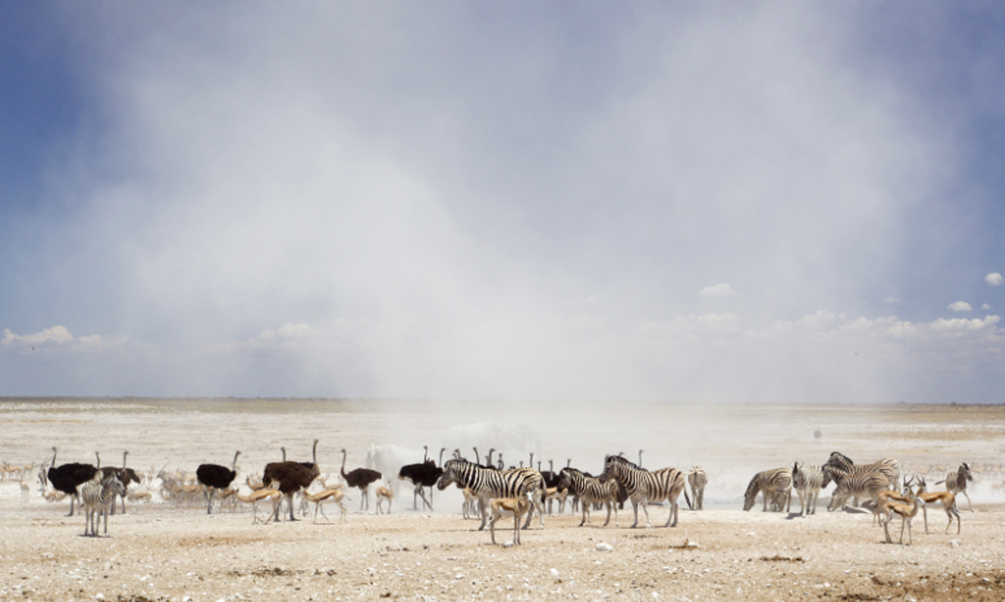
The abundance of game in Etosha National Park is somewhat unexpected, showcasing some of the most common and rarest wildlife species. The areas with thicker vegetation are home to elephant (some of the largest in Africa due to the vitamins and nutrients found in the ground), the endangered black rhino and even leopard. Lions are camouflaged in the pale- golden colour of the grasslands, while giraffes rise- high above most of the dry vegetation.
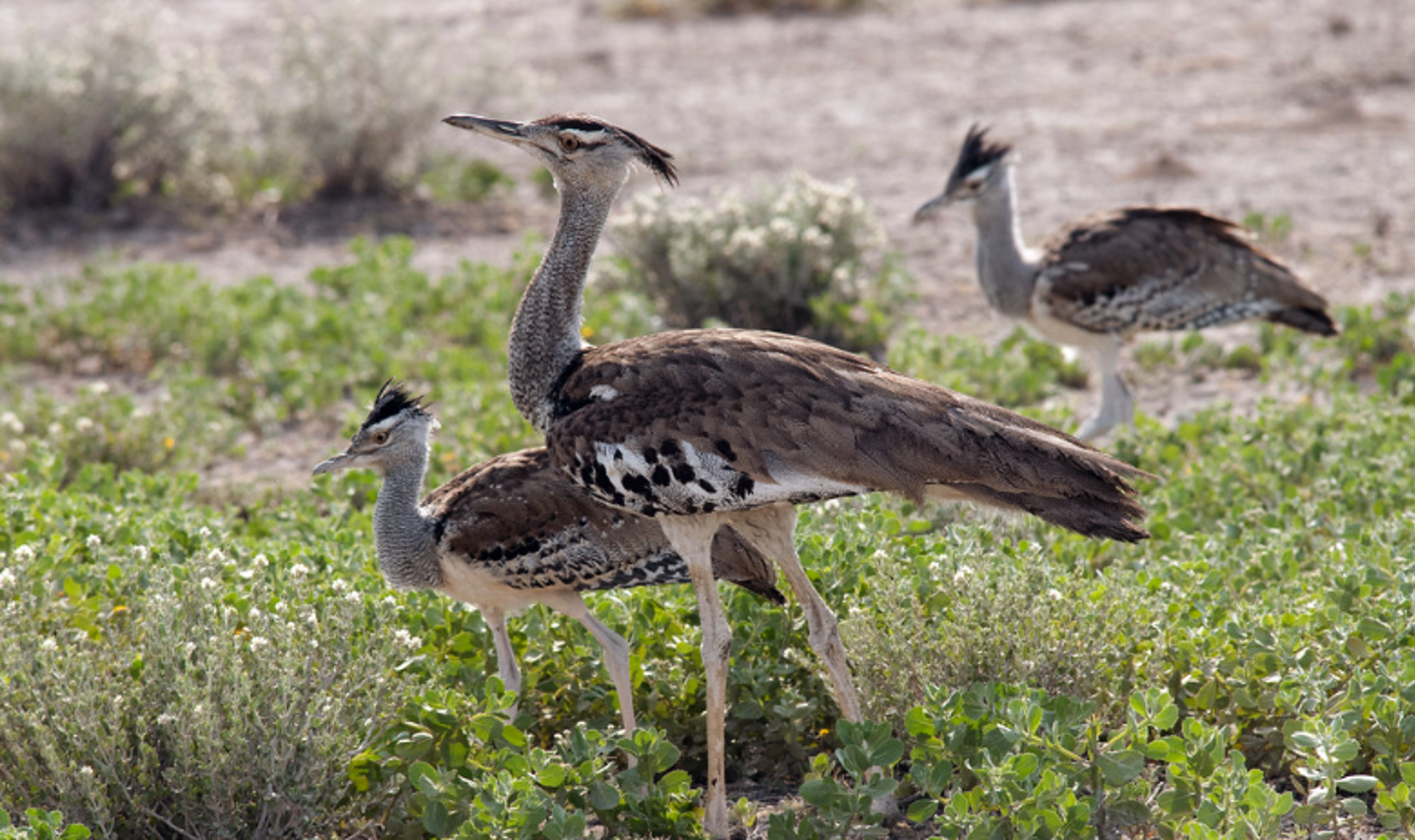
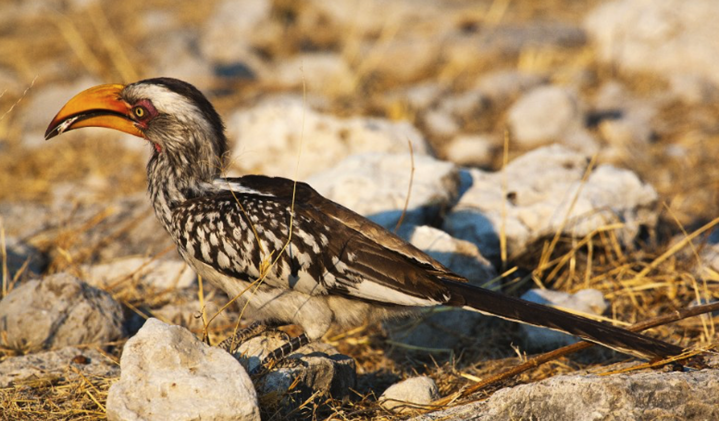
More than 340 bird species have been counted in Etosha National Park. Among the migratory species, the European bee-eater is possibly the most popular sighting. The game reserve is also home to the world’s largest bird, the ostrich, and the heaviest flying bird, the kori bustard.
Crews will have the chance to take a self-drive safari through the park, although anyone taking a convertible must have the top up and side windows fitted to be allowed into the park. The roads in the park are almost exclusively gravel of mixed quality with some tarmac roads being built during our route survey.
We drove and noted a typical route, but everyone will be issued with a guide book and easy to follow map so they can choose their own route. Those brave enough to take the side roads away from the main road through the park will be rewarded with some excellent game viewing away from the crowds. The guide book includes pictures of all the
animals in the park, and the fun was the crossing of those we spotted on our drive through. Black Rhino being a personal highlight.
The accommodation for the night is in a lovely lodge very close to the park exit, so crews will have all day to enjoy the spectacle.
Day 6 – Rest Day Etosha East
With such a lovely lodge to enjoy it seemed wrong to leave too early, so crews will enjoy a rest day in the lodge and the chance to see more of Etosha with expert guides. Alternatively, you can enjoy the facilities at the lodge and have a lazy day before the long run to Popa Falls.
Day 7 – Etosha East to Popa Falls
Today will be a transit day with crews needing to drive just over 600 Kilometres, but all on straight, good quality tarmac roads.
Fuel is available in a number of towns on route although there are no obvious lunch halts so we will be looking to get the lodge to provide a picnic lunch.
Although the day is long it is still very interesting, as Africa always is. Along the route we went through a veterinary gate at Mururani and after that the whole view out of the window changed. Before the gate we saw farms and fences, the gate seemed to be the entrance to rural Africa as suddenly there were people walking along the road, small villages of thatched huts, herds of cattle and goats wandering across the road with young attendants chasing after them and a number of locally produced items for sale on the side of the road.
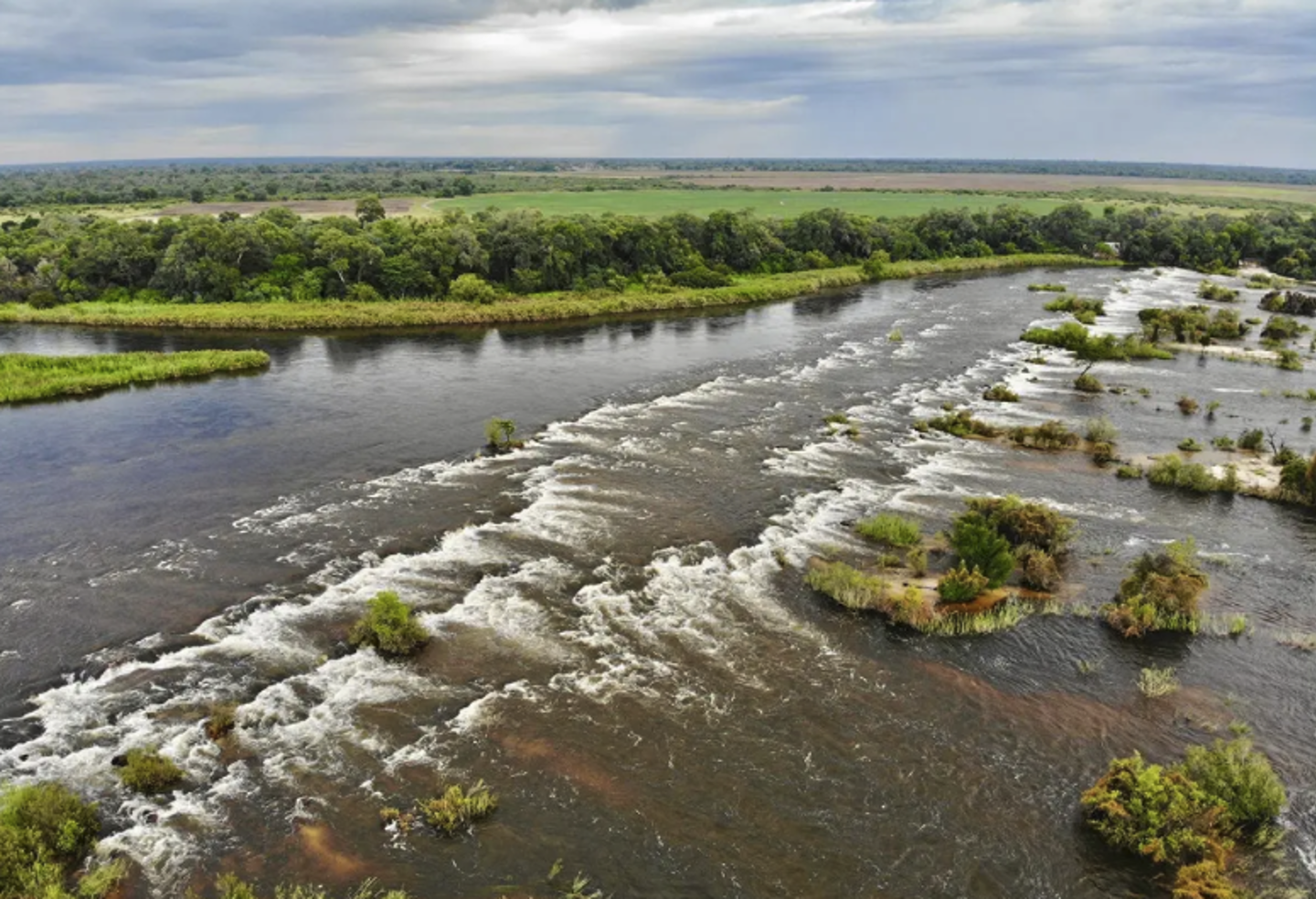
Our day’s journey ended at Popa Falls, but with very unseasonal rain falling we could not enjoy a “sundowner” overlooking the falls, something the crews should be able to do when the event arrives here.
The next day, we will cross into Botswana as we make our way towards the town of Kasane, the gateway to the Okavango Delta.
Day 8 - Popa Falls to Kasane
Heading away from Popa Falls the weather had improved and everything seemed so different in the sunshine.
After negotiating the first police point of the day, again we were just waved through with a smile and a raised hand, we entered the Bwabwata National Park.
The area is an important migration route from Botswana to Angola for African elephant and some other game species. It is an unusual Protected Area as about 5,500
people live in the park. The Namibian government involves park residents and neighbours in planning and managing the park
The first part of our journey took us along the Caprivi Strip, a geographic salient protruding from the northeastern corner of Namibia. It is bordered by Botswana to the south and Angola and Zambia to the north. Namibia, Botswana and Zambia meet at a single point at the eastern tip of the Strip, which also comes within 150 m (490 ft)
of Zimbabwe, thus nearly forming a quadripoint. Instead, Botswana and Zambia share this 150-metre (490 ft) border that intersects a bridge at the crossing of Kazungula.
The territory was acquired in 1890 by German South West Africa in order to provide access to the Zambezi River and consequently a route to the east coast of the continent and German East Africa. The route was later found not to be navigable because of the location of the Victoria Falls.
We reached the town of Katima Mulilo after 3 hours driving and remembered to turn right at the main road junction. Left would have taken us to Zambia.
With plenty of opportunities to get fuel we filled up, fuel in Namibia is cheaper than in Botswana, before completing the last 75 Kilometres to the Botswana border. Leaving town, we were stopped in a Police Checkpoint who wanted to see Rob’s International Driving Permit (IDP) and not his UK driving licence, something to note down for those of you looking to join us next year.
Leaving Namibia was very straightforward as we just needed to present our passports for stamping. As we were driving a South African vehicle the customs process was simple with no real checks, but the border is used to dealing with trucks and carnets so there should be little delay.
1.5 Kilometres later we entered the Botswana border post, parked as directed and headed into the office. Our passports were stamped and we were given a white slip to take to customs (actually just the next-door window) where vehicle details were taken, and a payment of 280 Pula was made for the permit to drive in the country. Credit Cards are accepted. We also had to declare the fuel we had in cans, there was no fee just a form to fill in and again something to note for the event next year.
The whole process was quick and efficient, and we were once again on our way.
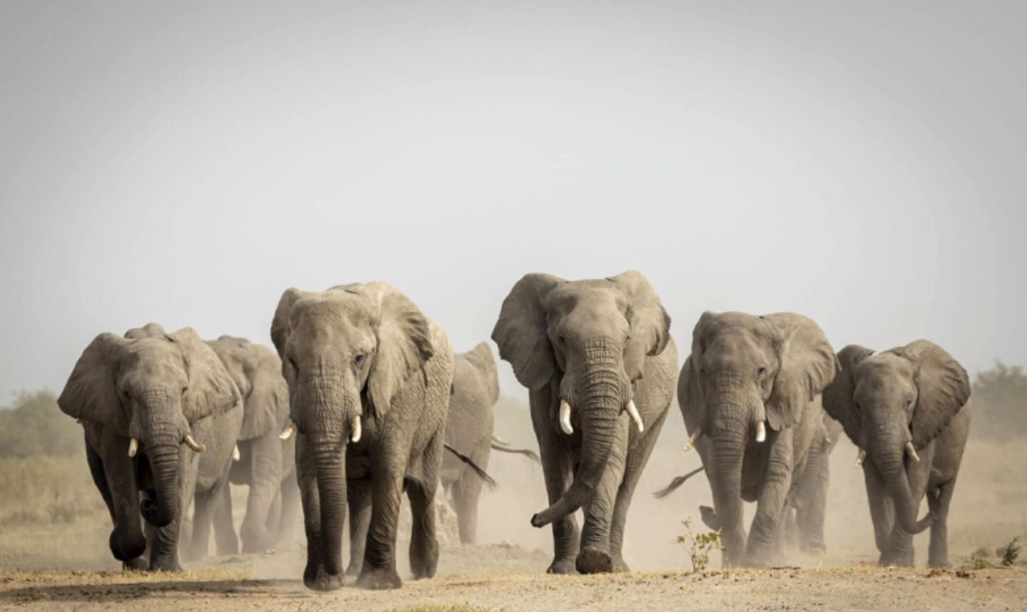
Just over a Kilometre after leaving the border we entered the Chobe National Park and started to look for signs of the huge Elephant population that lives there.
Our first sighting was very special to me as, after a number of trips to Africa over the years, I finally saw a Sable.
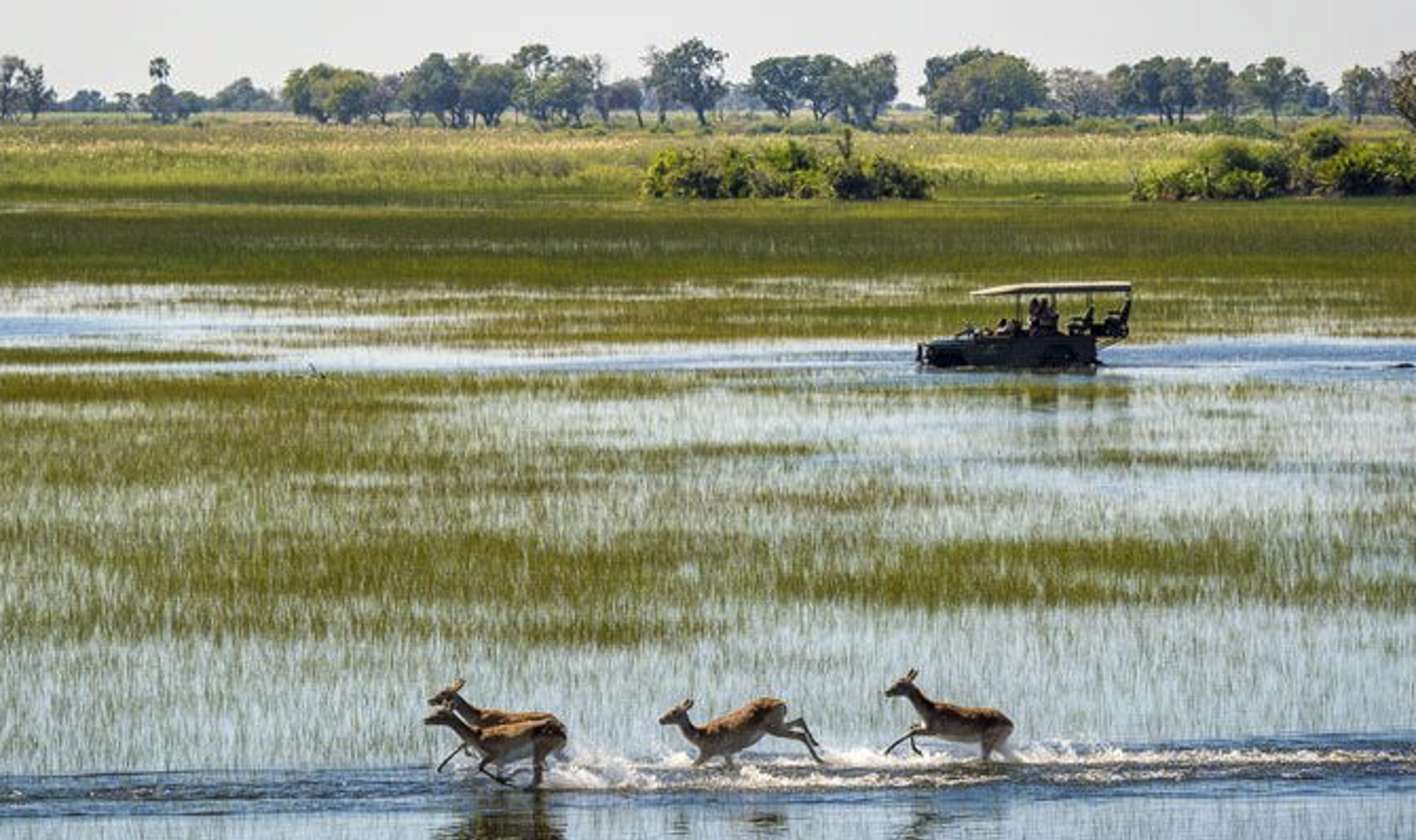
Established in 1968, Chobe National Park covers approximately 11,700 sq km, encompassing floodplains, swamps and woodland. The Chobe River forms the park's northern boundary.
The best way to view the National Park is either by organised game drive or by a river cruise, both will be available from the hotel for those who would like to see more.
We took the opportunity to have a river cruise and saw many Elephants, Crocodiles, Hippos and Water Buffalo, all while enjoying a cold beer in the afternoon sunshine. The
boat stopped on the way back to the hotel to allow everyone to get some wonderful sunset photos before dropping us off in time for a well-earned dinner.
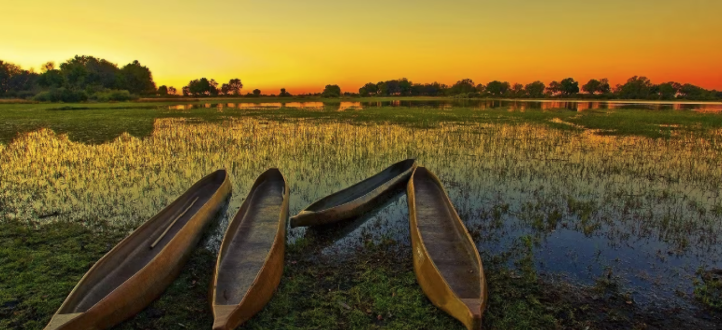
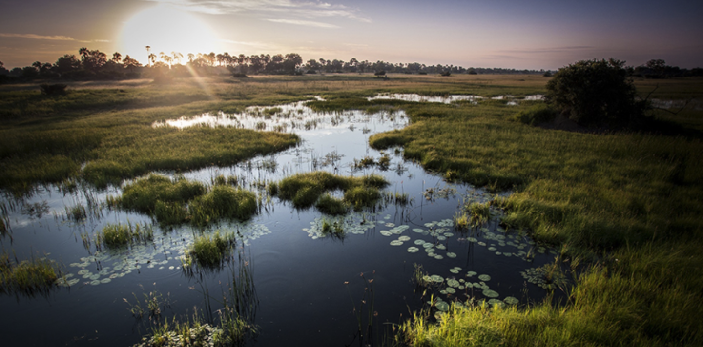
Days 9 and 10 – The Okavango Delta
For crews on the event the next two days will be one of the highlights and something they will remember for ever, a trip into the Okavango Delta.
Early morning flights will deliver crews to one of a number of camps in the Delta where they can enjoy some spectacular game viewing, wonderful food and an opportunity to completely relax. The cars will be securely parked so even the drivers can join in all the activities for a change.
This delta in north-west Botswana comprises permanent marshlands and seasonally flooded plains. It is one of the very few major interior delta systems that do not flow into a sea or ocean, with a wetland system that is almost intact. One of the unique characteristics of the site is that the annual flooding from the River Okavango occurs during the dry season, with the result that the native plants and animals have synchronized their biological cycles with these seasonal rains and floods. It is an exceptional example of the interaction between climatic, hydrological and biological processes. The Okavango Delta is home to some of the world’s most endangered species of large mammal, such as the cheetah, white rhinoceros, black rhinoceros, African wild dog and lion.
Day 11 – Kasane to Nata
Crews will fly back to Kasane after a leisurely breakfast and collect their cars for the secure parking.
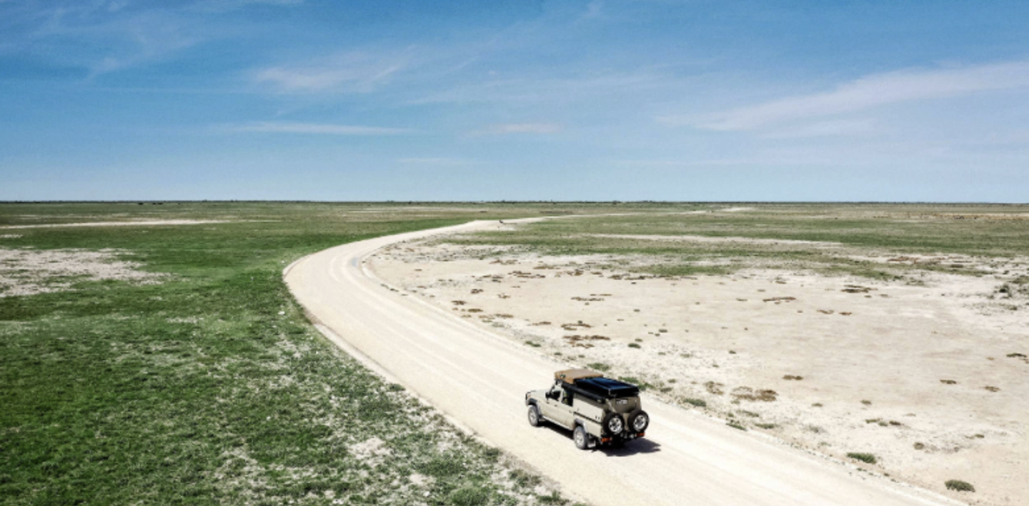
As crews will arrive at different times there will be no timing for today as crews make their way to the next overnight location in Nata.
There are many fuel stations in Kasane so crews can leave the town with full tanks to go with their full stomachs.
The road from Kasane to Nata is currently being completely re-built and will be massively improved from the current condition it is in. The journey to Nata is just over 300 Kilometres so it is not a long day to allow for the late start after the flights back from the delta. However, the journey will certainly be interesting as there will be another chance to see Elephants on the way south.
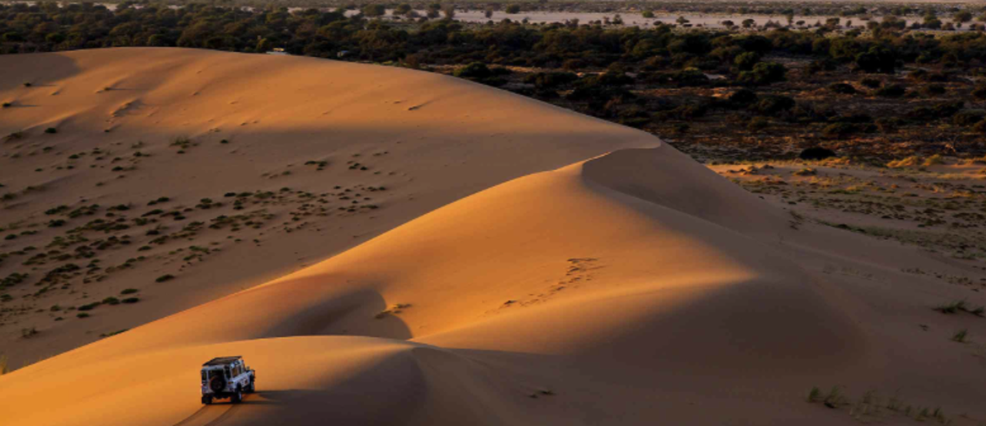
At Nata we continued the game viewing with an afternoon drive into the Makgadikgadi Pans and crews will be able to arrange a similar trip when they arrive.
The Makgadikgadi Pans are salt pans that approximately cover an area of 12000 sq. km, a remnant of the famous and ancient Lake Makgadikgadi that was once larger than Switzerland drying up thousands of years ago.
The Makgadikgadi National Park is home to a variety of wildlife like genet, caracal, lion, impala, zebra, wildebeest, jackal, bushbuck, cheetah, leopard, brown and spotted hyena, kudu, porcupine, to name but a few. There is also the possibility of seeing the rare white rhinoceros.
Day 12 – Nata to Francistown
Today there will be a late start on the event to allow crews a last chance to see the wildlife of Botswana with a morning drive into the salt pans for those who want an early start, or a late breakfast for those who would prefer a lie-in.
The journey to Francistown is only 200 Kilometres, but the road is being re-built so you can expect some diversions and the odd bump and pothole to navigate but should still arrive in Francistown in the early afternoon.
Francistown is the second-largest city in Botswana, with a population of about 103,417 inhabitants and is located at the confluence of the Tati and Ntshe rivers, and near the Shashe River (tributary to the Limpopo)
Francistown was the centre of Southern Africa's first gold rush and is still surrounded by old and abandoned mines.
There will be time to explore the town before dinner, there was a large local market close to the hotel when we arrived.
Tomorrow, we head south and into South Africa.
Day 13 – Francistown to Mokopane
We headed south out of the city so there was little traffic to worry about. The highlight of the morning was filling up at a new Shell fuel station complete with sound system and dancing attendants, neither of which were official, but great fun.
Due to a recent outbreak of foot and mouth disease, there were a number of veterinary check points where we had to get out of the car and disinfect our boots, all very friendly and helpful though.
Rather than stay on the main road to Gaborone, we turned off and used a slightly longer but generally traffic and truck free route to the border at Martin’s Drift.
My original plan had been to use a small border I had used on past events at a place called Zanzibar. Unfortunately, the border post closed during the pandemic and has not reopened, a great shame.
So, Martin’s Drift it had to be. We passed a long line of trucks on the approach, please remember to do the same if you are joining us next year, and headed into the border area working our way to the immigration and customs on the Botswana side. A very
straightforward process saw our passports stamped and vehicle papers checked before we crossed The “Great Grey-Green-Greasy Limpopo River” (as described by Rudyard Kipling) and into the South Africa border post.
Once again, the process was straightforward with passports stamped and vehicle papers checked before we were on our way again.
Our route took us down the R561 towards the village of Marken, a road I last used 8 years ago and it was more pothole than tarmac. We had also been told by a local that the condition was still bad, so it was a very nice surprise to drive on 20 Kilometres of new tarmac and then on a well graded dirt road.
Our venue for the night was the amazing Legends Golf and Safari Resort, and the event should be there on time for crews to take an evening game drive if they want to. Otherwise, a sundowner in the bar overlooking the golf course is another option.
Day 14 – Mokopane to Sabi Sands
Today gives me the first opportunity for a little light competition before we concentrate again on Africa’s finest, her wildlife.
There is both an oval track and a super kart circuit in Polokwane and we are looking to get permission to use both as test venues early in the morning. Should make a fun start to a mostly very scenic day.
After a short stop at the aptly named “Pancake Shop” near Tzaneen we drove through an area of Banana and Avocado growers then headed south towards the town of Lydenburg.
The colours of the rock in the hills was incredible, the most prominent being a yellow/green hue that I am sure a geologist will know what ore that might suggest. It just looked wonderful to me.
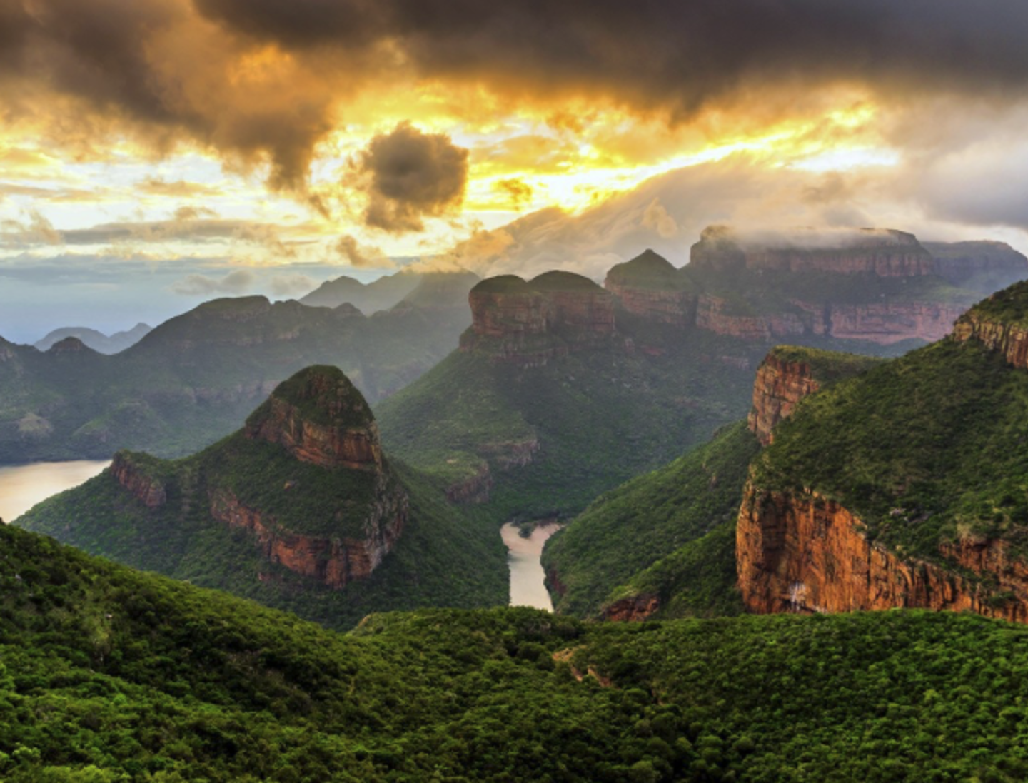
Crossing the Abel Erasmus Pass we headed towards the Blyde River Canyon and some even more amazing scenery.
The Blyde River Canyon is the third-largest canyon on Earth, behind the Grand Canyon and the Fish River Canyon. Unlike the Grand and Fish River Canyon, the Blyde River Canyon is a "green canyon" which is dominated by subtropical vegetation.
After wondering at the views on offer out of the car window we stopped at the famous God’s Window to stretch our legs and experience one of nature’s truly amazing views.
God’s Window is one of the Blyde River Canyon Nature Reserve’s most spectacular viewpoints, with astonishing views over South Africa’s Lowveld (so named because it is much lower than the high escarpment along which the Panorama Route runs). At God’s Window, majestic cliffs plunge down 700m and, on a clear day, you'll be able to see over the famous Kruger National Park towards the Lebombo Mountains on South Africa’s border with Mozambique.
A coffee was needed after all the excitement and the town of Graskop is a lovely place to stop. Very much a tourist destination there are some great souvenir shops and lovely cafes. However, crews mustn’t linger too long as they are headed for the next highlight of this incredible journey, Sabi Sands.
The road to the entrance at Shaw’s Gate has certainly suffered from the recent very heavy rains and although it will certainly be in better condition when the event is here you can still expect several bumps and potholes on your way in. The bumps will be worth it though when crews arrive at their allocated lodge for two nights of wonderful food and incredible game viewing.
Enough to whet your African appetite? There will be more from the great continent and Route Master Kim Bannister who is on the recce for the Classic Safari, 11th March – 15th April date 2027.
There are just few places left on the rally so go to the event page to check out the details and join us on this incredible trip.
Recce Report - Day 15 to Day 28
